Interactive map
Zurich-Singapore Public Space & Well-being Maps
Survey-based spatial datasets mapped to examine public space, urban vitality, well-being and social interaction across two city contexts.
Selected work across Zurich, Singapore and India: interactive maps, spatial indicators, public-space analysis, environmental mapping and planning visualisation.
Live Folium/Leaflet maps from survey-based spatial datasets. Switch between the combined view and city-specific outputs for Zurich and Singapore.
A fast overview for applications: live maps first, then spatial analysis, mobility work and the full planning portfolio.
Survey-based spatial datasets mapped to examine public space, urban vitality, well-being and social interaction across two city contexts.
A personal interactive map project on everyday urban navigation, food geographies and user-generated spatial memory in Singapore.
Competition map hosted as a live web project, showing urban mobility, accessibility and visual storytelling through a browser-based spatial interface.
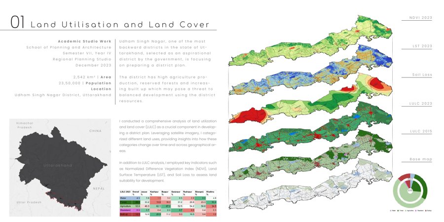
District-scale environmental and spatial indicators including LULC, NDVI, land surface temperature, soil loss and development suitability.
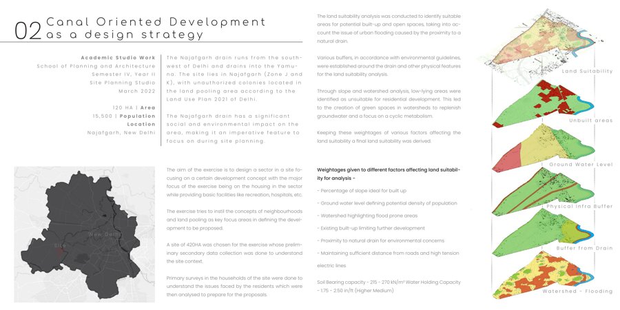
Spatial design strategy integrating development, public space and environmental systems through planning visualisation and scenario-based design.
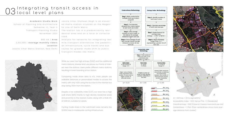
Local-level accessibility and transit-oriented planning work connecting spatial networks, routes, facilities and planning interventions.
Studio work, spatial analysis, design strategies and planning visualisation. The viewer below is intentionally large so the pages can be read directly in the browser.